Garmin Tread XL Overland, All-Terrain Navigator, Rugged, Built in Mapping, iOverlander, Ultrabright Display, Large (Renewed)Yetkazib berish bilan eng yaxshi to'liq narx: 13 854 424 soʻm
- Mahsulot
- 10 809 508 soʻm
- Forvarding (qayta yuborish)
- 522 706 soʻm
- Bojxona boji + QQS
- 2 522 211 soʻm
- Jami
- 13 854 424 soʻm
17-oktabr, 2026 kursi bo'yicha hisoblangan
Yangilangan 16-avgust, 2026
Do'kon takliflari · 1 forvarding usulini tanlang — summalar qayta hisoblanadi
Forvarderlar va omborlar →- Amazon USEng foydaliDo'kondagi narx10 809 508 soʻm· $899.9962 kun oldin tekshirilgannarx o'zgargan bo'lishi mumkinForvardingMyUS · from the US · ≈ 14 kun · ombor: Флорида (USA)Soliqlar 2 522 211 soʻmJami13 854 424 soʻm
Do‘konlarga havolalar hamkorlik havolalari: xariddan komissiya olishimiz mumkin, narx siz uchun o‘zgarmaydi.
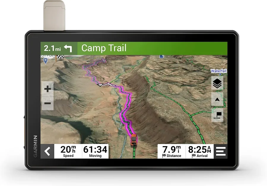
Rugged, weather-resistant all-terrain navigator with 10” ultrabright display; includes locking magnet-assisted mount for securing in your rig. (IP67; Dust tight. Withstands ingress of dust with vacuum applied. Withstands incidental exposure to water of up to 1 meter for up to 30 minutes.) • Turn-by-turn trail navigation for unpaved roads and trails using adventure roads and trails map content. (Limitations may exist in map data for some road and trail route suggestions. Always defer to all posted road signs and conditions during vehicle operation. The Garmin OpenStreetMap products are intended to be used only as a supplementary travel aid and must not be used for any purpose requiring precise measurement of direction, distance, location or topography.) • Comprised of OSM and USFS Motor Vehicle Use Maps, City Navigator road maps for custom street routing take into account the size and weight of your rig. (Not available in all areas. Entering your vehicle’s profile characteristics does not guarantee your vehicle’s characteristics will be accounted for in all route suggestions. Always defer to all posted road signs and road conditions.) • Preloaded topographic maps with 3D terrain of North and South America, U.S. public and private landowner information and subscription-free BirdsEye Satellite Imagery via direct-to-device download. • Built-in inReach technology offers global satellite communication, two-way text messaging, location sharing and interactive SOS. (Requires an active subscription. Some jurisdictions regulate or prohibit the use of satellite communications devices.) • Preloaded with iOverlander points of interest and Ultimate Public Campgrounds, so you don’t need a cell signal to route to the best-established, wild and dispersed campsites. • Pair with the Tread app on your compatible smartphone to track friends using the Group Ride Mobile feature, sync your trip data across all your devices and plan routes with the same maps, vehicle profiles and route pref
O'xshash mahsulotlar
Barchasi →